How Tooting Meadow was named
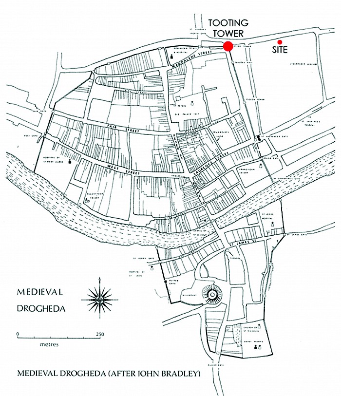
Drogheda is a historic town with a rich heritage. The name ‘Tooting Meadow’ comes directly from the site’s historical context and proximity to a tower on the town wall. Drogheda’s old town walls had various towers at key vantage points. Tooting Tower was located at the junction of the north and east walls, where King Street and Scarlet Street now meet. An older name for King Street was Tooting Tower Lane. Tooting Tower would have been the closest structure on the town walls to the site and is shown below on the map.

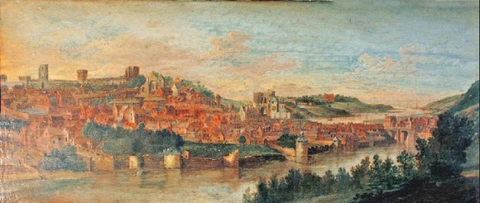
In old historic views of Drogheda, the site east of Tooting Tower was depicted as meadows and grasslands. In urban terms a key concept for the proposed development was to create a visual connection to the parkland setting and mature trees of the Sienna Convent and the proposed development visually opens the site and Scarlet Street to this green space.

Tooting Meadow refers to the site’s location in historical, geographical and physical terms. McKevitt King Architects and the North and East Housing Association put forward a list of names to Louth County Council’s Placenames Committee who selected Tooting Meadow as the most appropriate name for the development.
Please vote for ‘Tooting Meadow’ in this years RIAI Public Choice Awards at the following link


